Excavations at Castle Hill Country Park, Beaumont Leys (2016-present)
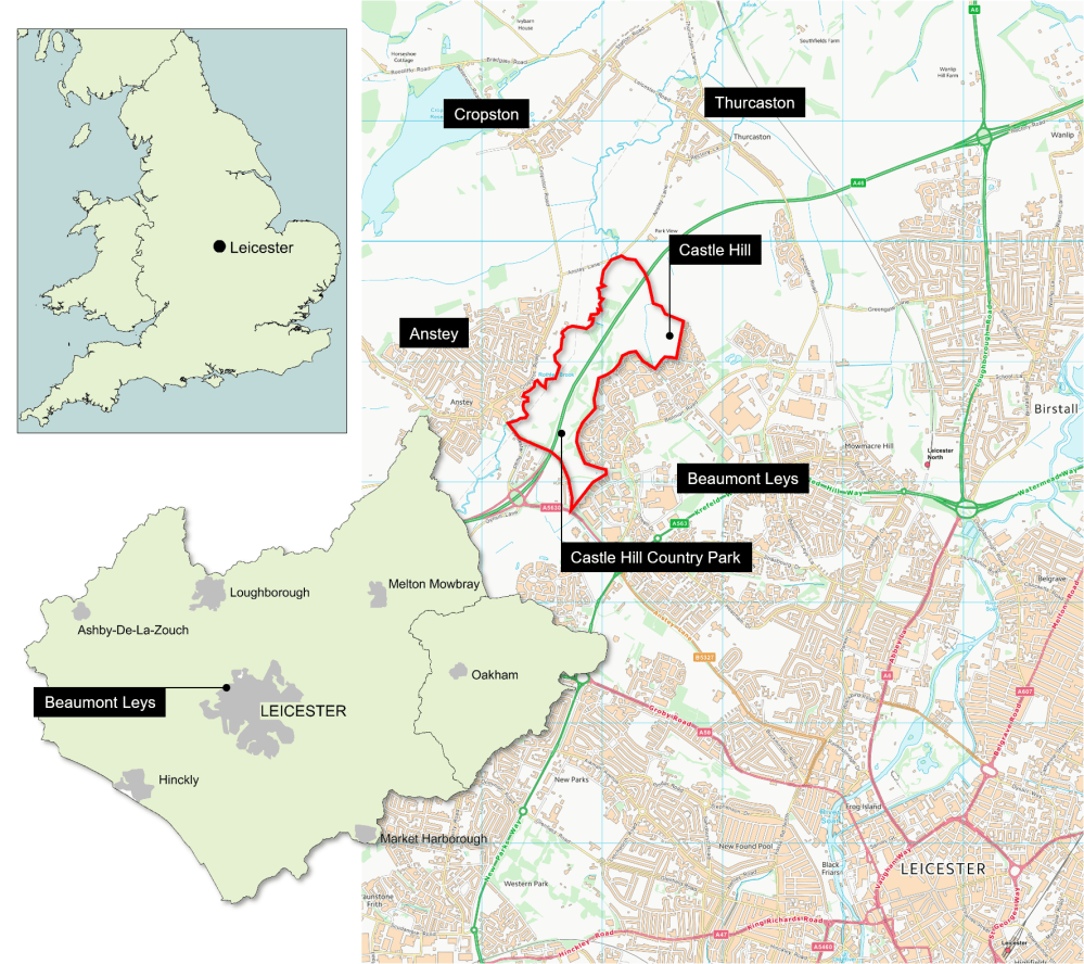
On the northern edge of Leicester, between Beaumont Leys and the villages of Anstey, Cropston and Thurcaston, is the little-known and enigmatic rectangular earthwork called Castle Hill. Today it is a Scheduled Monument, situated in a large country park which bears its name. Since attention was first drawn to it in the 19th century, it has been the source of much speculation, with theories ranging from Iron Age hillfort to Roman encampment or Anglo-Saxon fortification. More recently is has been linked with the medieval Catholic military order, the Knights Hospitaller.
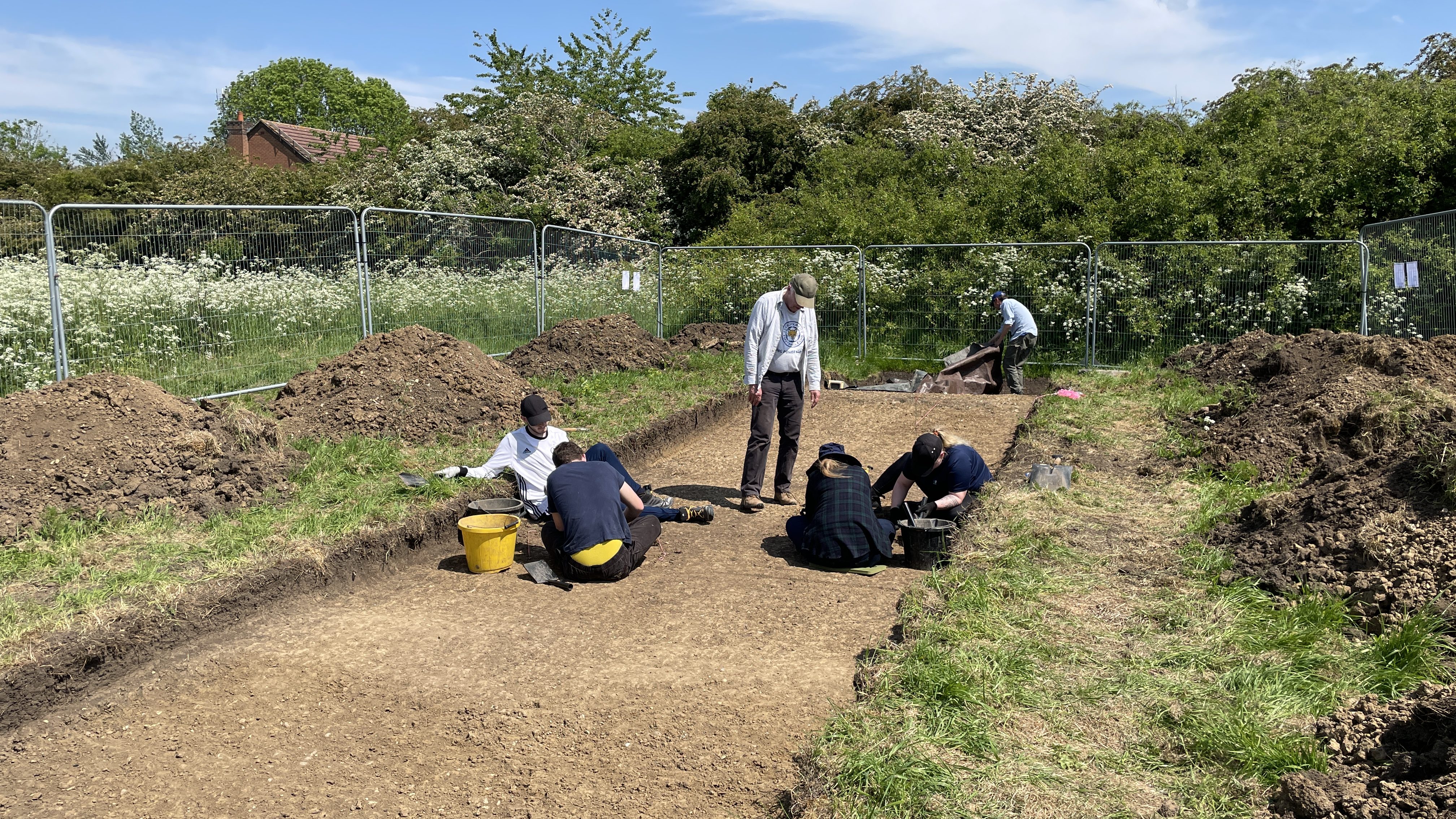
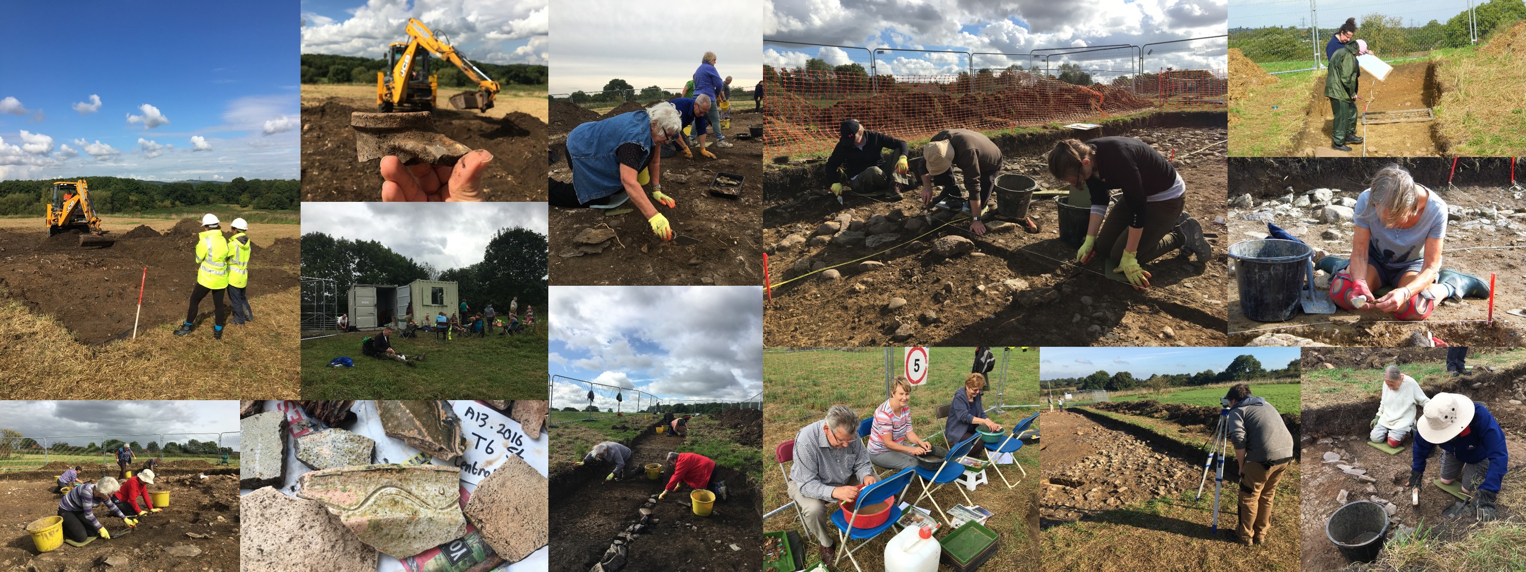
In 2016, the University of Leicester partnered with Leicester City Council to run a programme of archaeological excavation at Castle Hill. The digs were initially part of the Story of Parks project, a two-year scheme to help collect and celebrate the history of the city’s parks through the stories and memories of the local people that used them. This was made possible with a grant from the National Lottery Heritage Fund and gave volunteers from the community a unique hands-on opportunity to explore the heritage of their local area. To complete the programme of research started in 2016, a new programme of excavation started in 2021 as an archaeological fieldschool for students from the University of Leicester’s School of Archaeology and Ancient History (SAAH) and volunteers from the local community.
During the project, volunteers from the local community and university students were given a fantastic opportunity to develop a wide range of practical and analytical archaeological skills through on-site training and supervision by a team of archaeologists from University of Leicester Archaeological Services (ULAS).
This has helped increase our knowledge, understanding and appreciation of the setting, origins and development of Castle Hill and its environs, has stimulated interest in the heritage of the local area, and has aided long term conservation of the monument.
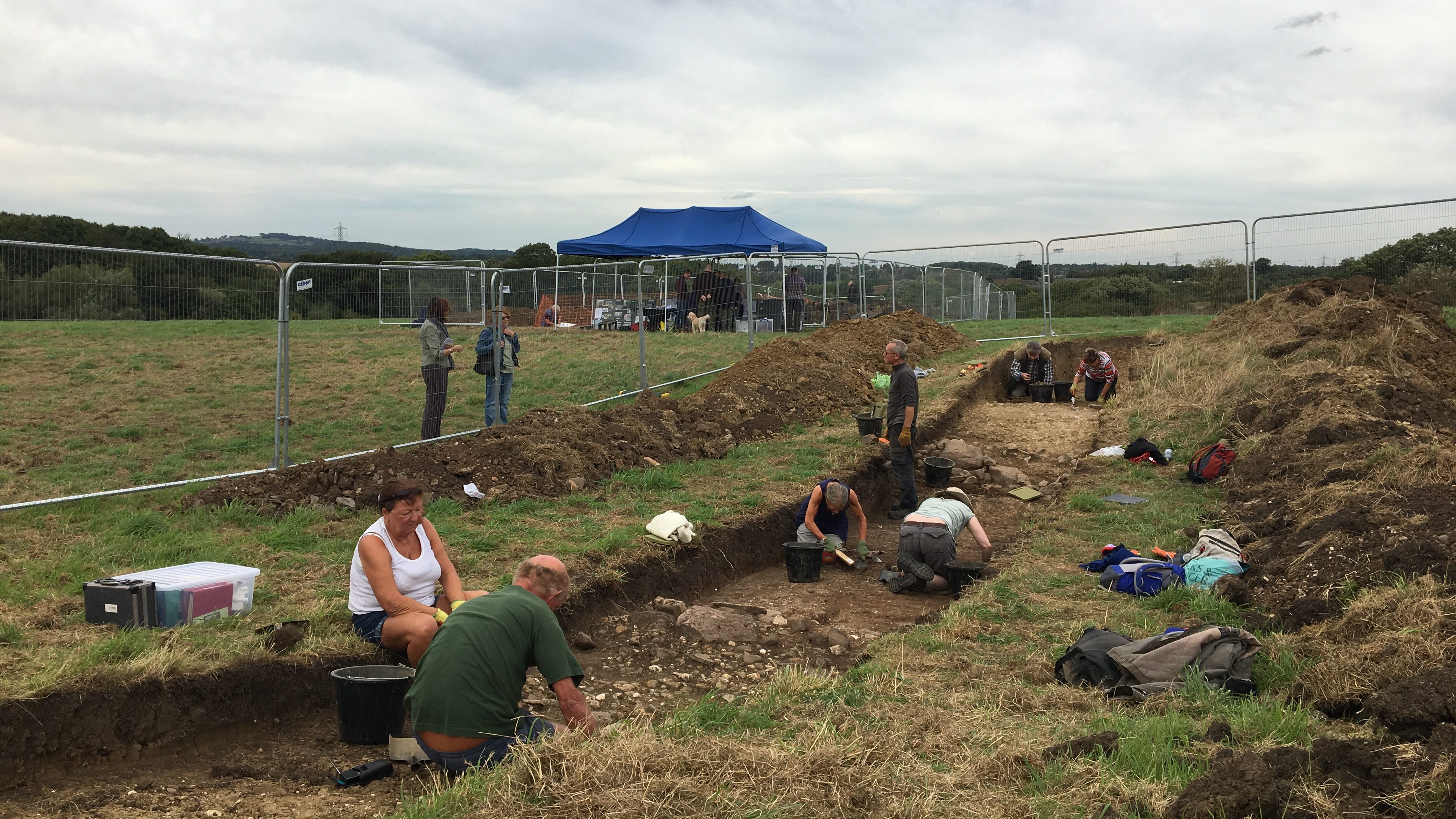
In all, over 90 volunteers and 60 students have taken part in the excavations under the guidance of University of Leicester archaeologists. In 2022, the project also featured on BBC 2’s Digging for Britain with Alice Roberts (Series 9, Episode 4).
What is Castle Hill?
The earthwork called Castle Hill is a large sub-rectangular ditched and banked enclosure measuring 200m by 150m. Inside the enclosure are numerous other earthworks including two circular earth mounds. To the east is a linear boundary bank, and to the north a large fishpond and dam. Ridge and furrow earthworks also survive to the north, east and west of the enclosure.
The monument appears to have alluded early antiquaries but by 1884 was shown as a ‘supposed encampment’ on Ordnance Survey maps. In 1891, local historian F.T. Mott suggested that it might be an Iron Age or possibly an Anglo-Saxon stronghold. Better understanding of the site was hindered through much of the late 19th and 20th century by the unknown effect to it by the Beaumont Leys Sewage Farm but the earthwork was considered significant enough in 1980 to warrant statutory protection. Further confusion arose in the 1980s, however, when it was mistakenly described as a preceptory of the Knights Templar. Today, it is generally recognised as a medieval estate centre associated with the Knights Hospitaller, although there are still many unanswered questions to its true age, purpose and state of preservation.

In the medieval period, Beaumont Leys (simply called Beaumont then) lay on the edge of Leicester Forest. In the 11th and 12th centuries it was held by the earls of Leicester as part of the manor of Thurcaston before Simon de Montfort, 6th Earl of Leicester (1208-65) granted it to the Knights Hospitaller in the mid-13th century.
In the 14th century, the Hospitallers were described as having a house and orchards at Beaumont, as well as arable and pasture land and meadows. These appear to have been kept by a bailiff and a wood keeper who were administered from the Hospitallers’ preceptory at Old Dalby. A fishpond was also mentioned in the 14th century. The Hospitallers held the site until 1482 when they exchanged it with King Edward IV for the more profitable rectory of Boston in Lincolnshire. Edward IV converted the estate into a deer park but by the mid-16th century it had been turned over to pasture.
In the 19th and 20th centuries, the site was used as a sewage treatment works which potentially caused extensive disturbance to the underlying archaeology. Today, the site is part of the Castle Hill Country Park maintained by Leicester City Council.

Why dig at Castle Hill?
Not knowing anything about the site, the primary goal of the project has been to develop a broader understanding of the nature and survival of the archaeology, which will aid future study, management and conservation of the site. Surprisingly, given the enduring appeal of the ‘warrior monk’ in popular culture, the archaeological character of the Knights Hospitaller in Britain has seen limited investigation.
Scholarly interest in the militant orders can be found in antiquarian accounts as early as the 16th century. Studies of their properties in Britain, however, have not necessarily been relevant to these interests. Where research has taken place, it has invariably focused on standing structures, particularly churches and chapels and has been driven by interests in the history and architecture of these sites not their archaeology. Some Hospitaller sites have had programmes of limited excavations (Beverley in East Yorkshire, Carbrooke in Norfolk and the main priory at Clerkenwall in London for instance) but their form, layout and activities still remain poorly understood.
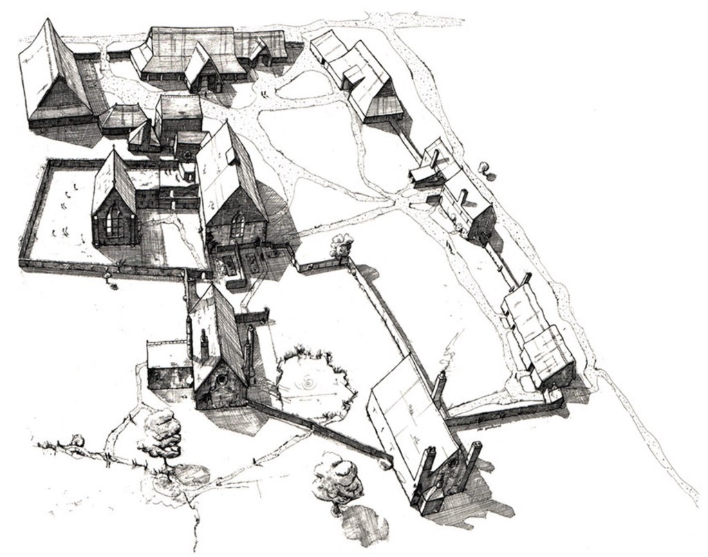
One exception is the Knights Templar preceptory at South Witham in Lincolnshire. Its complete excavation in the 1960s revealed a large 13th-century building complex including a hall, chapel, kitchen, barns, animal houses, brewhouse/dairy, gatehouses and a watermill arranged around a series of open spaces and surrounded by a shallow moat, fishponds and a mill pond. The South Witham preceptory has come to be seen as the standard form for this type of site, but is it a typical example? Without comparative evidence this remains far from clear.
Archaeological excavation at Castle Hill provides a unique opportunity to investigate in detail a Knights Hospitaller site. In 1338, the manor at Beaumont was described as a membra (dependant manor) of the preceptory at (Old) Dalby. A survey of Knights Hospitaller lands in England in the mid-14th century lists 36 preceptories (administrative centres), 30 camerae (independent manors) and 21 membra. So far, membra sites are poorly understood and none have been excavated previously.
The archaeological excavations
So far, excavations have focused on the enclosure’s outer bank and ditch, a possible entrance into the enclosure, the eastern boundary bank, one of the central mounds and an area of ‘building rubble’ identified through geophysical survey in the north-western part of the enclosure.

The enclosure’s outer bank and ditch
A key aim of the project has been to definitively date the monument and resolve speculation about its past function. Did it have an Iron Age, Roman or Anglo-Saxon origin, as 19th-century antiquaries had suggested, or was it entirely built in the medieval period?
Trench 11 set out to answer this question. On the north side of the enclosure, the LiDAR survey suggested that ridge and furrow earthworks ran beneath the bank and ditch. Ridge and furrow is a pattern of linear ridges and troughs created by a system of ploughing used in Europe during the medieval period. If it could be proved that these earthworks pre-dated the enclosure it would be a significant step forward in answering this question.
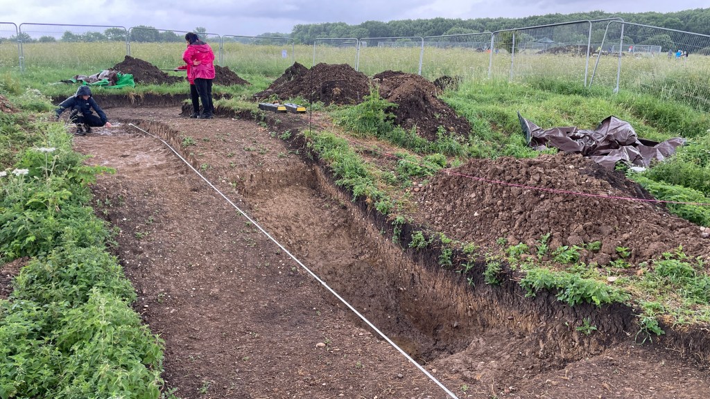
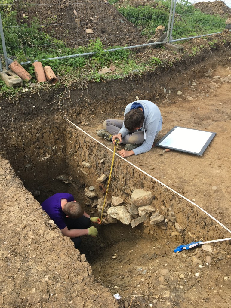
Excavation revealed that the northern enclosure bank was built of clay cast up from digging the ditch. The bank was 6m wide and still survived to a height of 1m above ground level outside the enclosure. There was no evidence for a wall or palisade on its summit but extensive erosion had caused the bank to spread and slump back into the ditch. Instead, a simple fence or thick hedge may have topped the bank, leaving little to no trace evidence. The ditch was originally 5m wide and 1.5m deep. Even without a wall on top of the bank, it and the ditch would have still presented a substantial obstacle to cross for any livestock or unwanted guests.
Significantly, traces of ridge and furrow were found beneath the bank and pottery from soil in the furrows dated to the 13th century. This proves beyond doubt that the enclosure was constructed in the medieval period, around the time the Knights Hospitaller were given the estate. Before this, the land at Castle Hill was under cultivation.
The entrance
As part of the investigation of the outer bank and ditch, Trenches 1 and 4 focused on an area on the eastern side of the enclosure. Here, the LiDAR survey had revealed two parallel linear earthworks approaching the enclosure through the ridge and furrow. These were interpreted as a trackway approaching an entrance into the enclosure.
The bank and ditch in this area were of different construction to that recorded to the north. The bank was 11m wide and only survived to a height of 0.5m above ground level. It was constructed from clay mixed with a large quantity of poorly sorted stone rubble, predominately local Charnwood diorites with smaller quantities of Swithland slate and fieldstone. Again, there was no evidence for a wall or palisade. The ditch was 5.5m wide and over 1.4m deep, and was broken by a 6m wide causeway of undug ground which formed an entrance across the line of the ditch into the enclosure from the high ground to the east. Pottery of mid-13th to early-14th century date was recovered from the ditch.
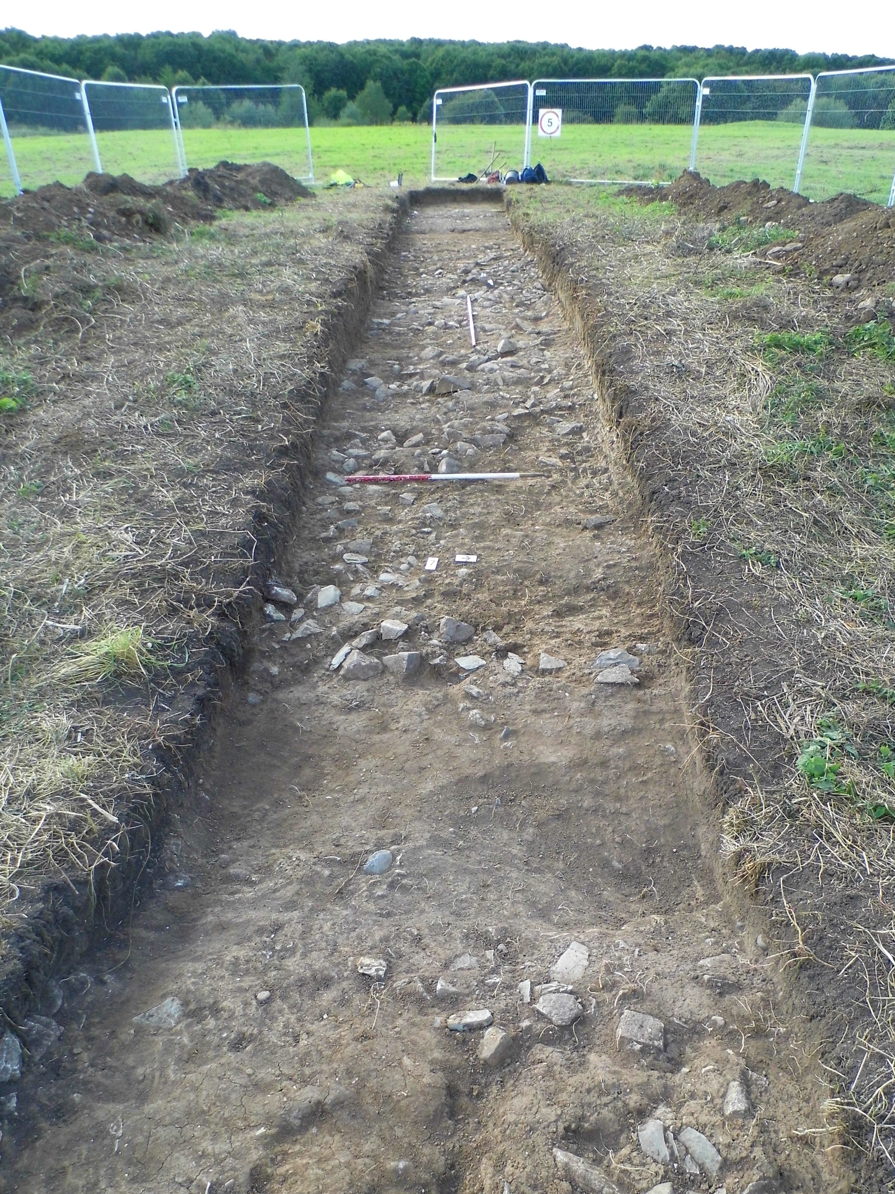
At some unknown date, parts of the ditch were deliberately backfilled with building rubble brought from an unknown location, perhaps to widen or reinforce the edges of the entrance causeway. In the 19th century, the slight hollow of the silted up ditch was reused as a drain, with a ceramic pipe running down its length. This was probably a drain associated with the site’s inclusion in the Beaumont Leys Sewage Farm.
The eastern boundary bank
Approximately 12m east of the main enclosure, Trench 12 investigated the eastern boundary bank. In the site’s scheduling, this was described as a 300m long, north/south orientated boundary feature comprising a wide shallow bank and an infilled ditch to its east. Its purpose was unclear, was it part of the medieval landscape, was it a later park pale or was it part of the sewage works?
Excavation found that the bank was a shallow convex build up of clay, 5m wide and 0.3m high. To the east, the ground dropped into a wide, shallow hollow. No ditch was found and instead it was likely to have been a sunken trackway flanked to the west by a hedgebank. Dateable finds from the trench were scarce but given that both features respected the surrounding ridge and furrow, a medieval date seems most likely.
Aerial photographs taken before the housing estates surrounding Castle Hill were built in the 1970s and 1980s, clearly show extensive ridge and furrow surrounding the site. These arable fields were crossed by a series of connected drove roads and trackways which would have allowed farmers to safely move their livestock between areas of grazing without damaging their crops.
The central mound and hollow, and other earthworks
In the centre of the enclosure, geophysical survey had suggested that a hollow adjacent to one of the earth mounds contained a rectangular ‘structure’.
Excavation of Trenches 2 and 5 revealed the hollow to be a pond, with the mound of earth resulting from its digging out. An exact date for the pond could not be established but a land drains constructed from pitched Swithland slates was dug across it. The drain remained undated but slate was only widely used in drains before mass production of ceramic pipes became cost-effective in the 19th century. This suggested that the pond had silted up but remained boggy sometime before the 19th century. The residual hollow was later been adapted as an evaporation pool for the sewage farm and a 19th-century ceramic pipe exited into it.
The ‘structure’ proved to be the stone lining surrounding the pond, probably to stop its edge becoming churned up by animals. This suggests that the pond was a watering hole for livestock or deer in the medieval or post-medieval period, sometime between the 13th and 19th century.
Excavations along the western side of the enclosure (Trenches 7-9) found two large pits inside the enclosure, in its north-west corner. These were probably quarry pits dug to extract the local clay in the post-medieval period. No other archaeology was found.
The ‘building rubble’
Geophysical survey suggested that large parts of the northern half of the enclosure were covered by disturbed magnetic results, most likely rubble or modern debris. Excavation of Trenches 3, 6 and 10 has found that the rubble covered a large hall building, possibly the house mentioned in the 14th century.
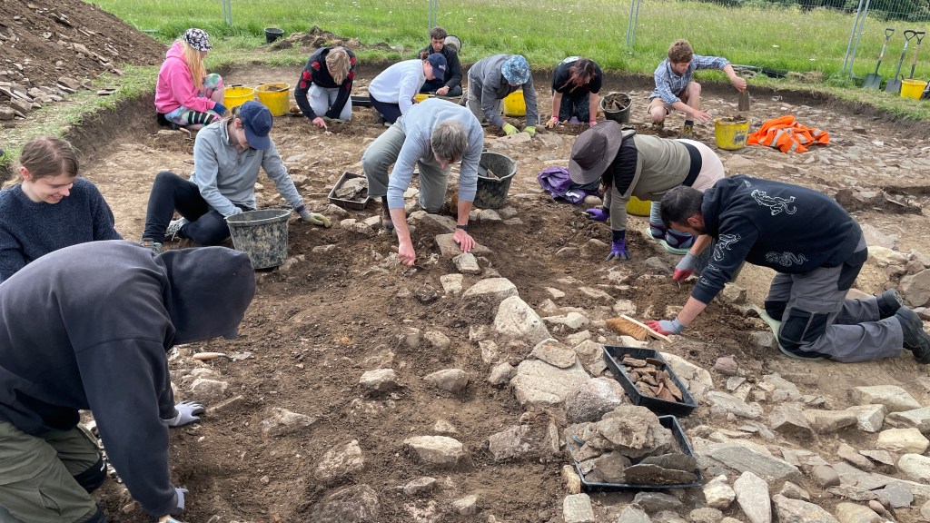
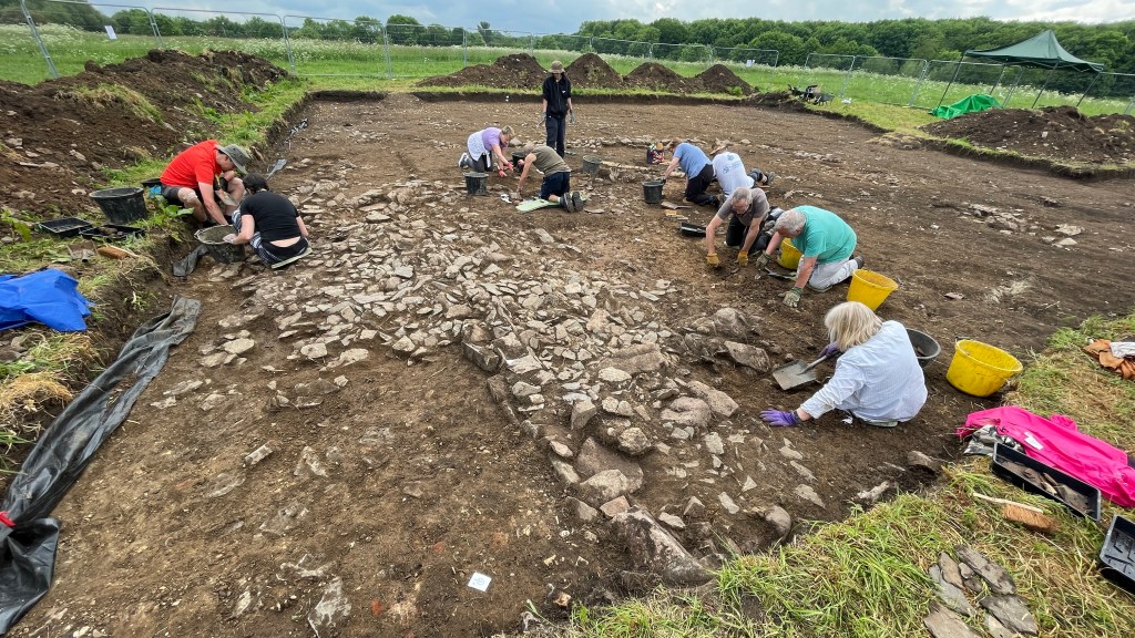
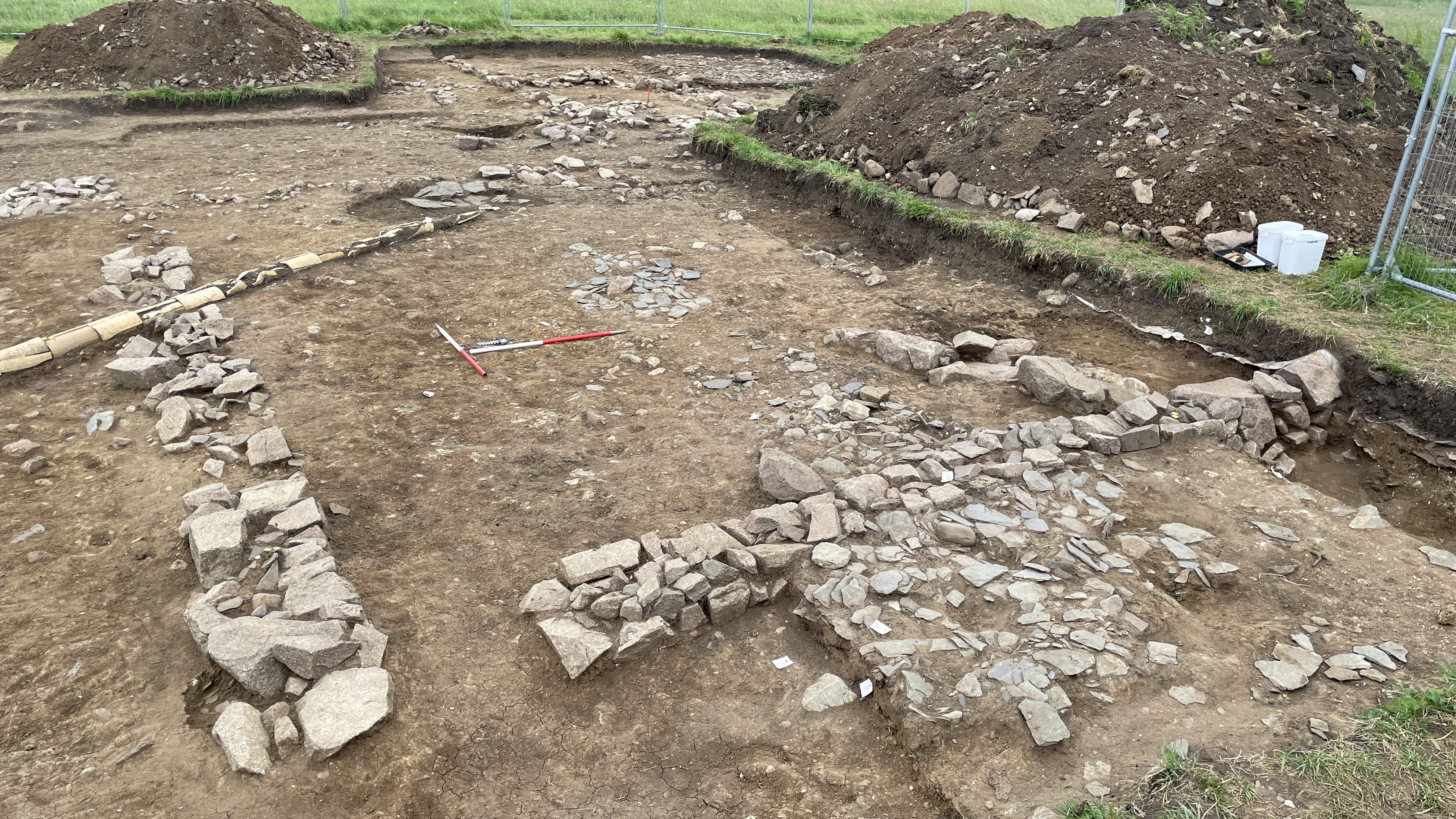
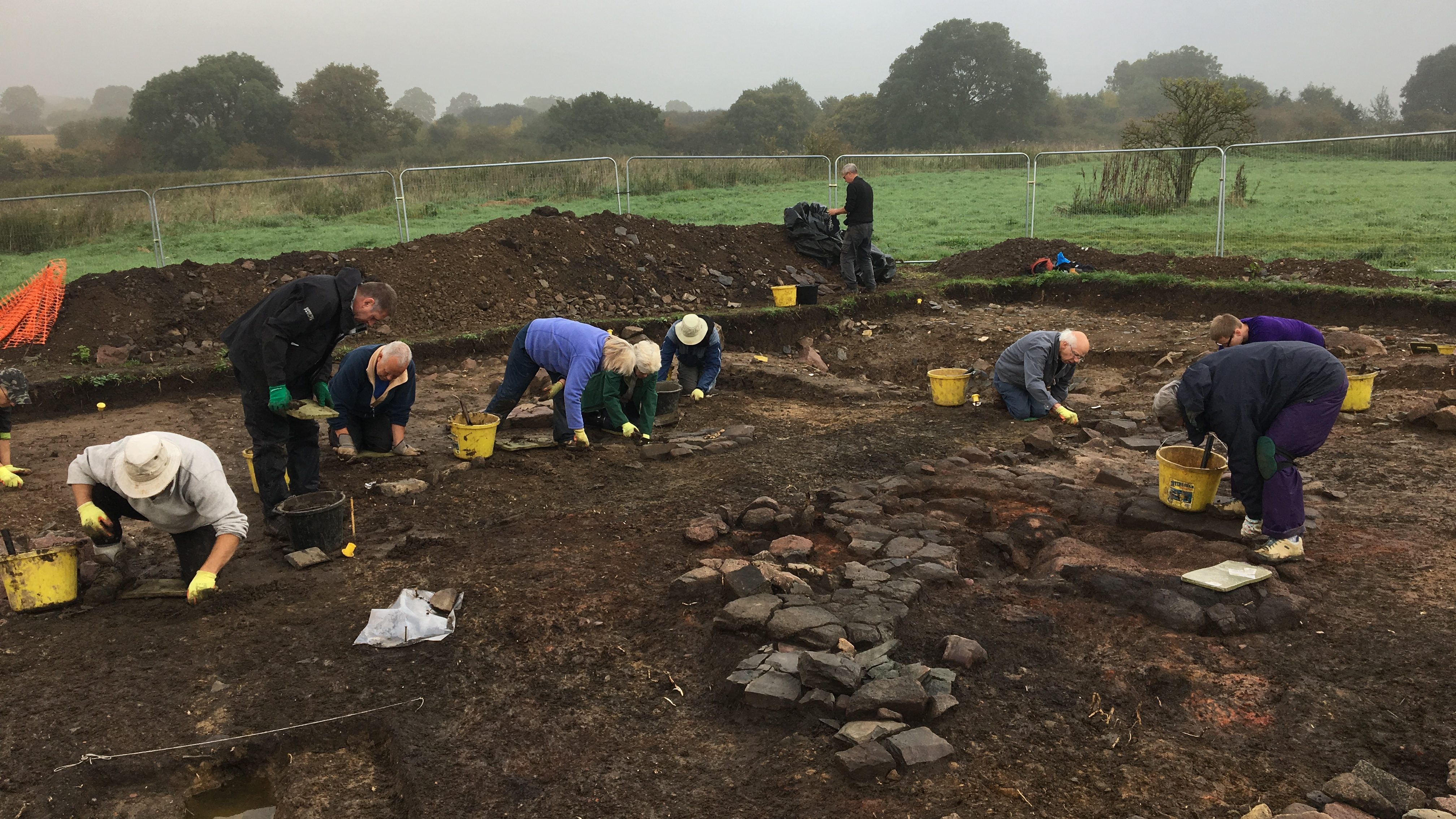
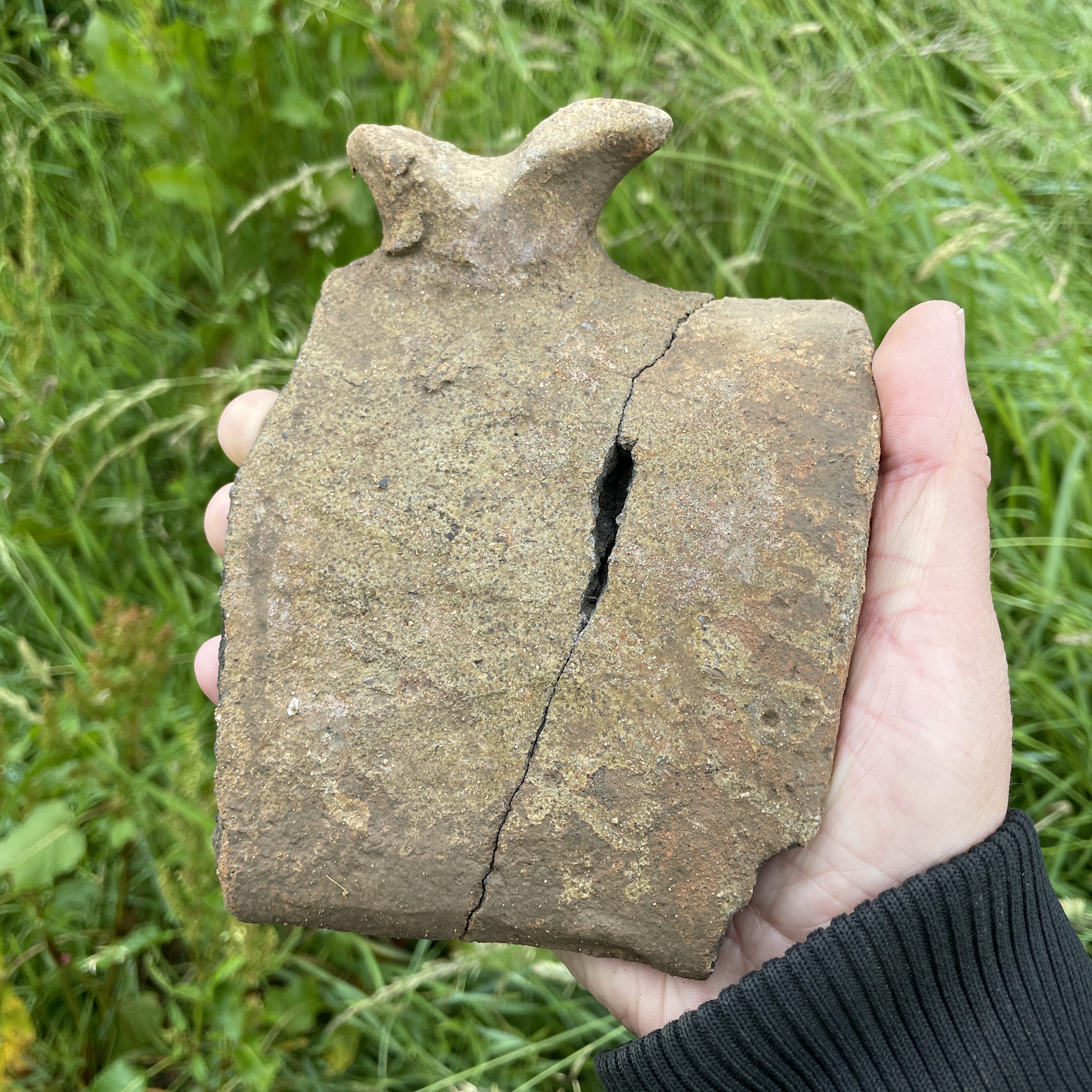
Surviving walls indicate that the building was 9m wide and over 18m long, most likely divided into a central hall with service rooms to the south and a parlour to the north. It would have been timber framed, with the framing resting on low stone plinths. The roof was slate, capped with decorative glazed ridge tiles. A small square platform projecting off its eastern side may be the footing for an oven, or an external staircase, tower or porch, whilst a central hearth indicated that the hall was open to the roof. Further walls extended to the west appeared to represent a covered walkway, presumably leading to other buildings.
To the south and east of the building were large yard areas. To the south, a possible lean-to structure was added to the southern gable end of the building. In the yard east of the building was a well.

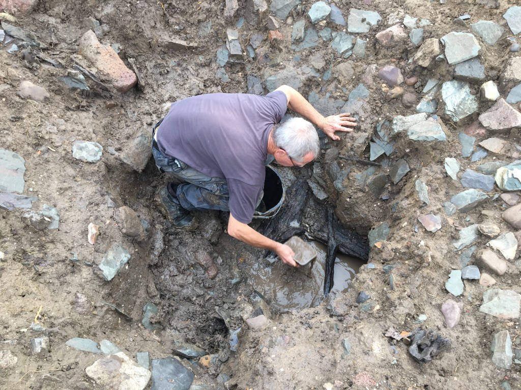
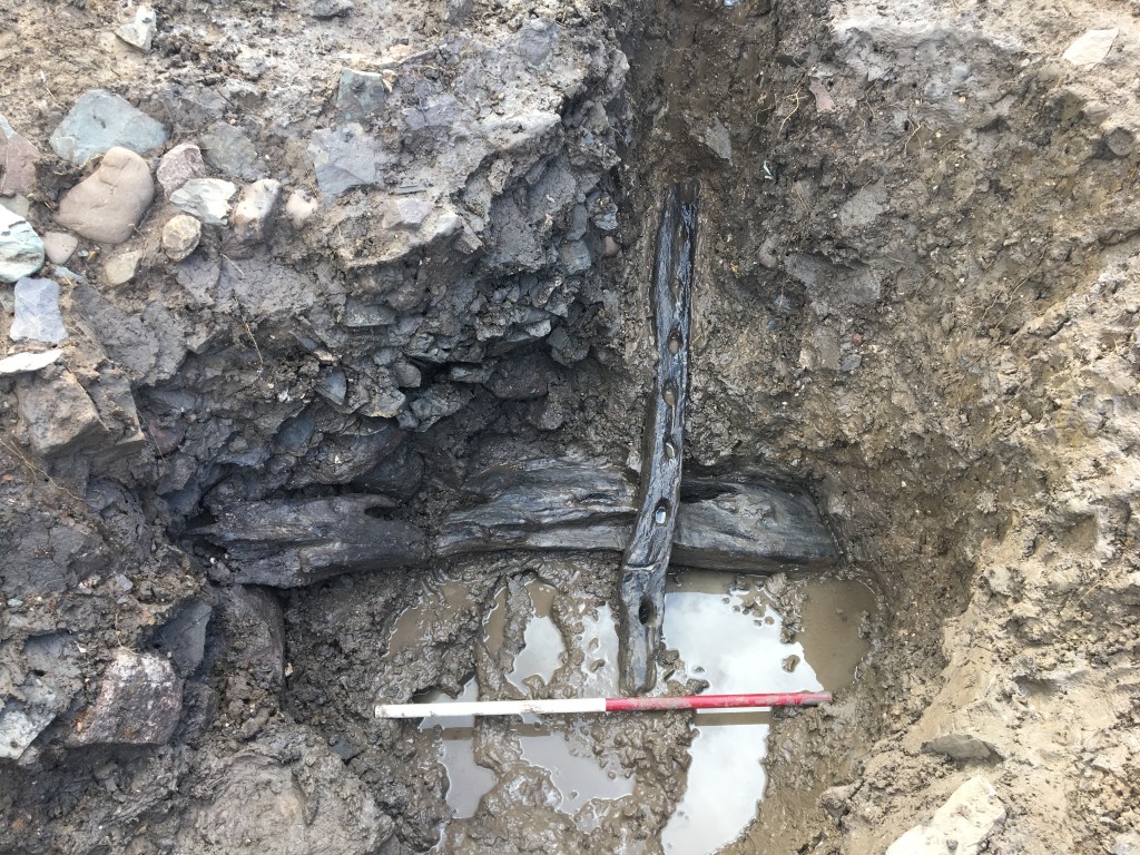
Pottery suggested that occupation of the building began in the mid-13th century and ceased by the end of the 14th century. In the hall, the final user of the hearth was a blacksmith, and a large quantity of smithing waste was recovered from around the building. Afterwards, parts of the building entered a period of dereliction before it was demolished (soil generated over the floor in the southern room and an unburied deer carcass was found beneath the demolition deposits). During this clearance of the site, the well was filled in with building rubble, including a rare, well-preserved group of building timbers which had survived because of the waterlogged conditions.
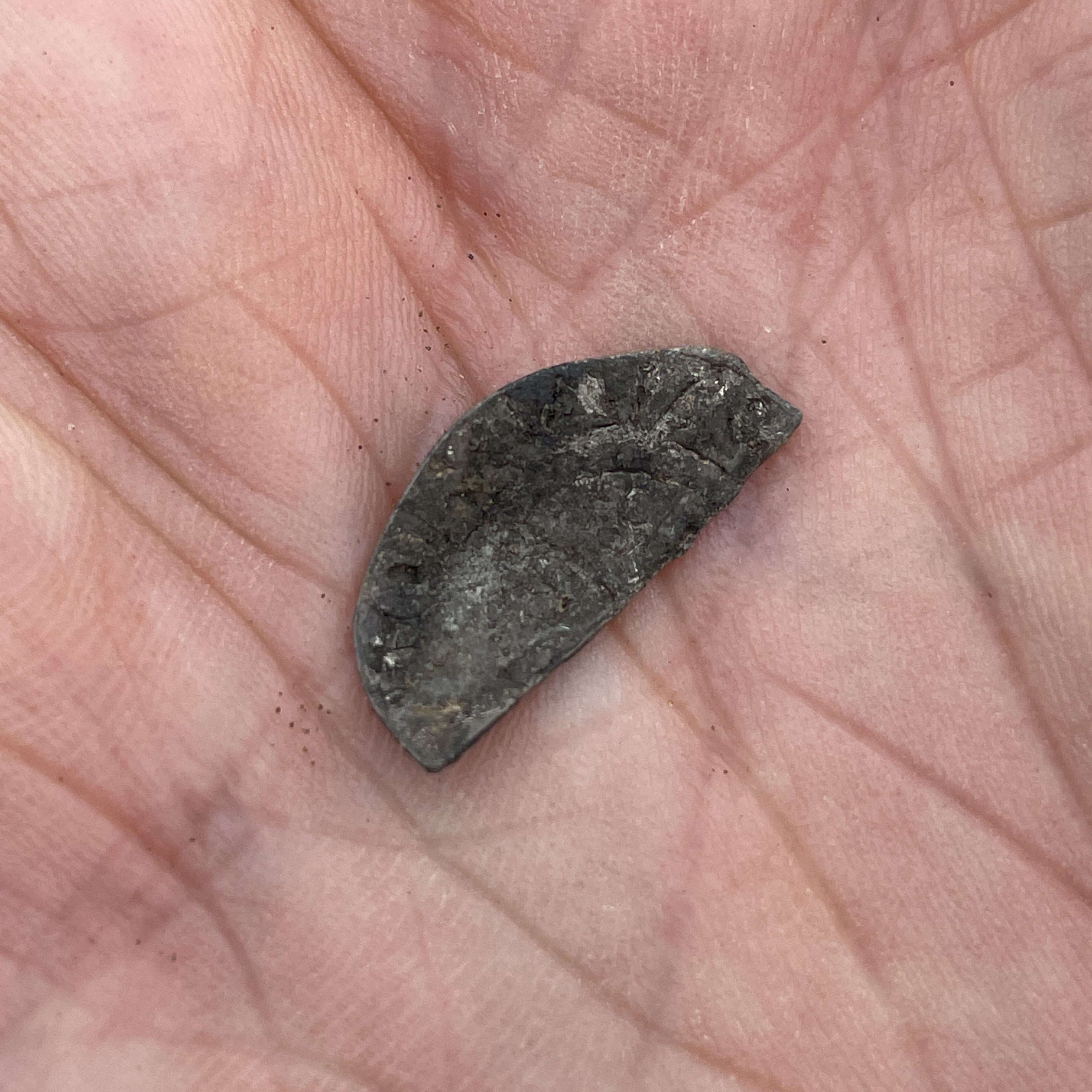
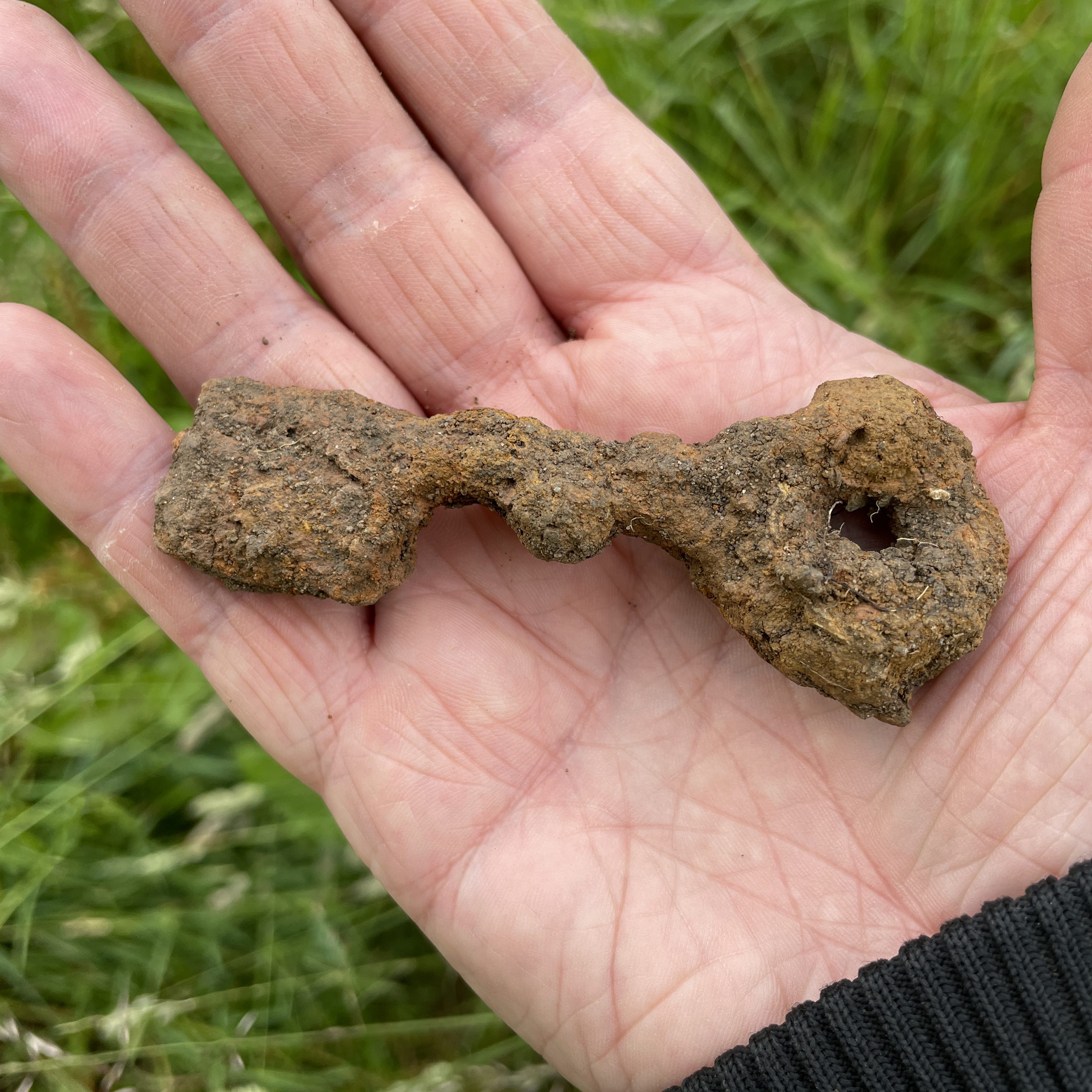
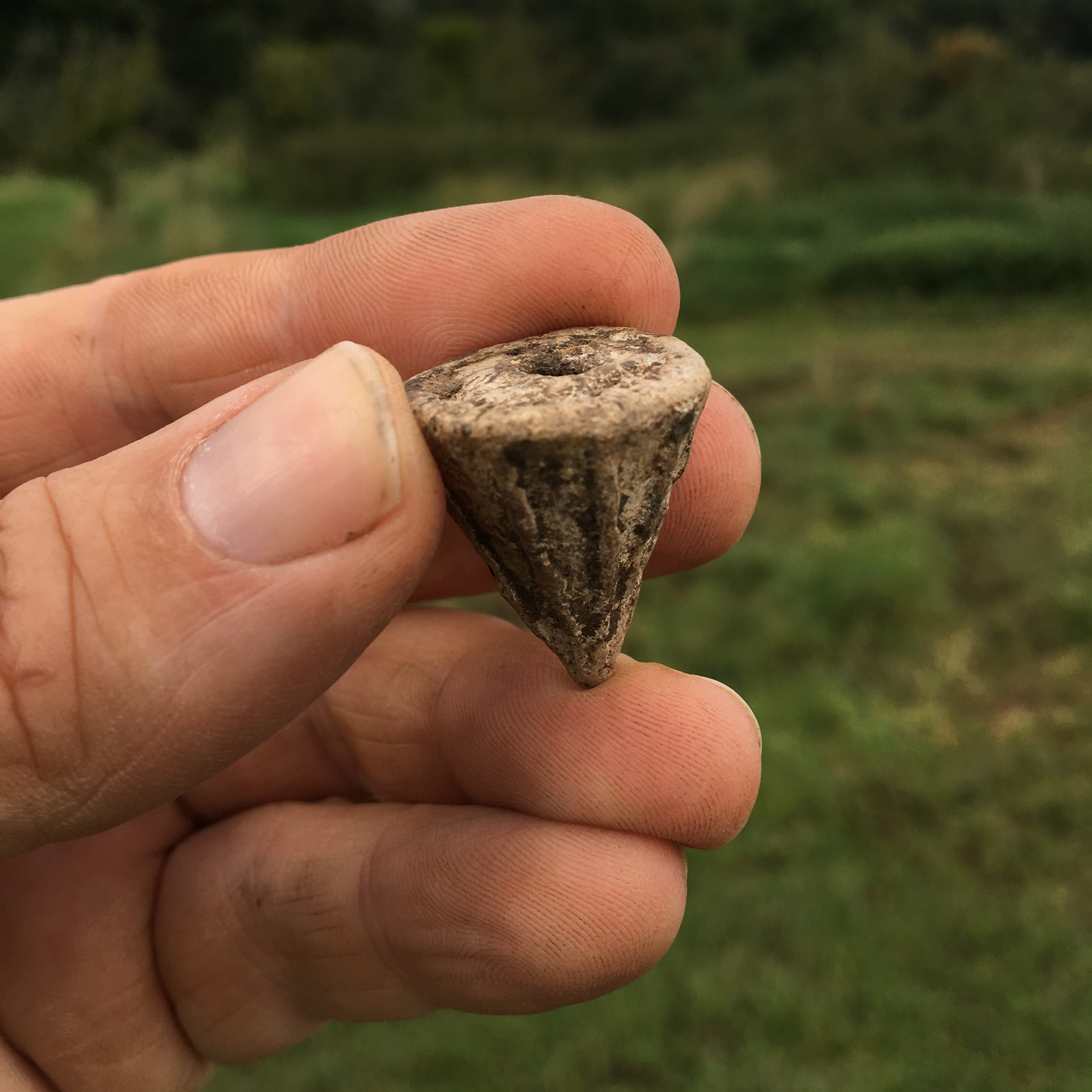
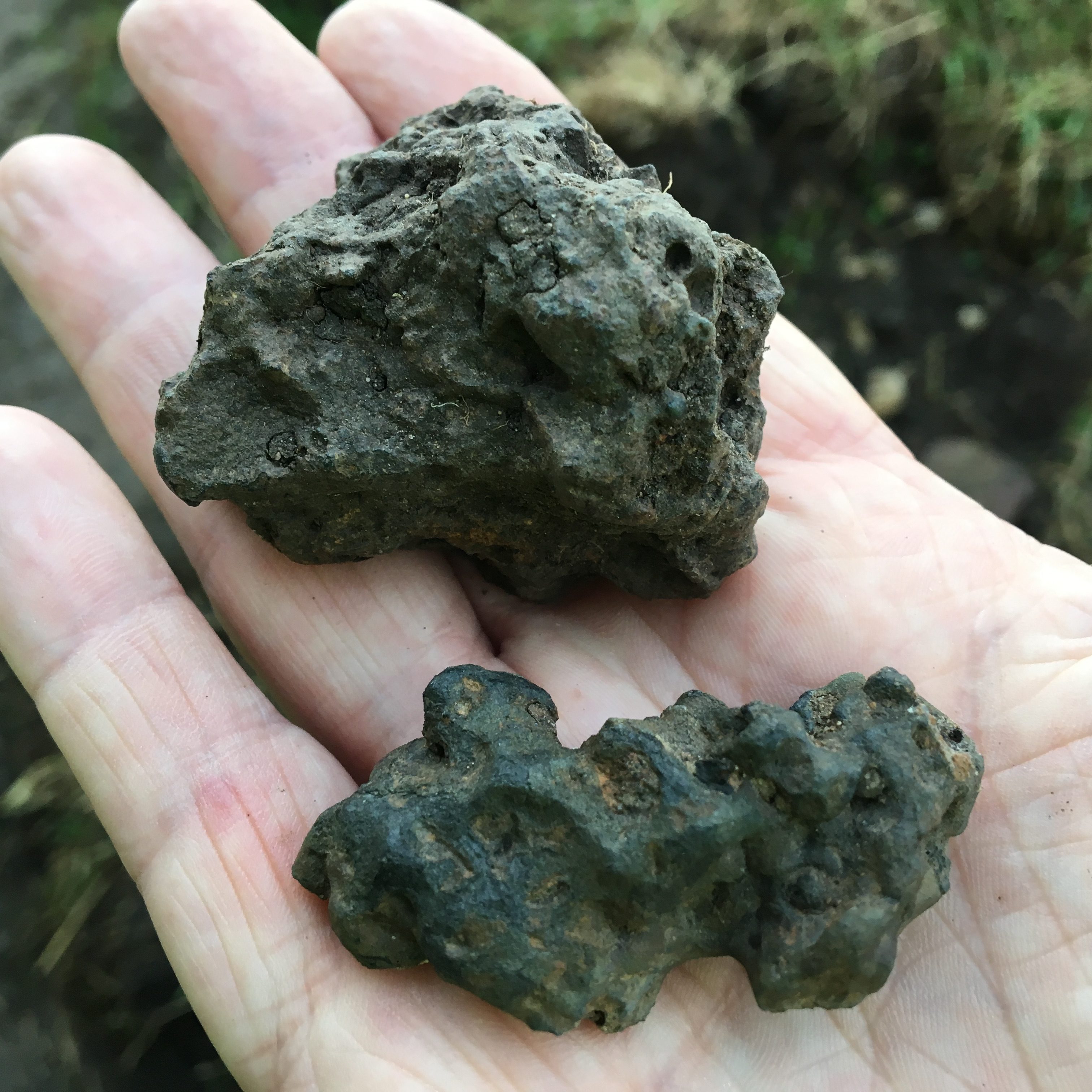
Artefacts from the site

What we now know and what comes next…
Following three seasons of excavation at Castle Hill we have considerable expanded our knowledge of the site. We now know that the damage from the 19th/20th-century sewage farm is minimal and the underlying archaeology is well preserved. At least one earth mound is a result of earth movement during the digging of a later medieval or post-medieval watering hole (the second mound remains unknown, with potential older origins which could be investigated in future digs).
The enclosure is surrounded by a large ditch and substantial soil bank, perhaps topped with a fence or hedge. There is no evidence that the ditch permanently contained water but even dry, the ditch and bank would have provided a serious impediment to rogue livestock and uninvited guests. The excavations have also proved, beyond doubt, that the enclosure was built in or after the 13th century, and is therefore an entirely medieval monument. At least one entrance has been confirmed on the east side of the enclosure, linking with a network of trackways and droveways crossing the high ground between the Soar Valley and the Rothley Brook. LiDAR has possibly identified a second entrance on the western side, which could be investigated in future digs.
There is at least one sizeable building in the north-west quarter of the enclosure. It was 9m wide and over 18m long and was probably a timber-framed hall, surrounded by yard areas, with further buildings to the west, although the wider layout and the scale of the building complex remain unclear. The building was constructed in the mid-13th century and had become derelict by the end of the 14th century. This is consistent with acquisition of the manor of Beaumont by the Knights Hospitaller in around 1240 and might explain why they gave it up in 1482 (by the 15th century it was a failed venture which was more profitable to shed from their real estate portfolio).
A fourth season of excavation is planned for 2023. This will continue to investigate the complex of buildings in the north-west quarter of the enclosure and will investigate the western bank and ditch, and a second putative entrance into the enclosure.
Project Collaborators