In 2016, ULAS carried out work on a large five-hectare excavation at Leicester Lane, Enderby, on the western edge of Leicester close to the M1. An extensive and rich Prehistoric site was identified. Project Officer Wayne Jarvis reports:

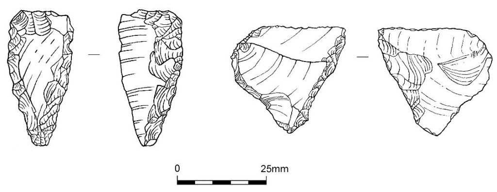
The site covered an area of land that included lower lying flat ground and a slope up to a plateau. On the plateau, which was the central area of site, was a rare assemblage of Early Neolithic material, the first evidence of such from this part of the county. This material was found in two small pits, and included worked flint, pottery, and plant remains. The pottery and radiocarbon material indicated activity from around 5,500 years ago.
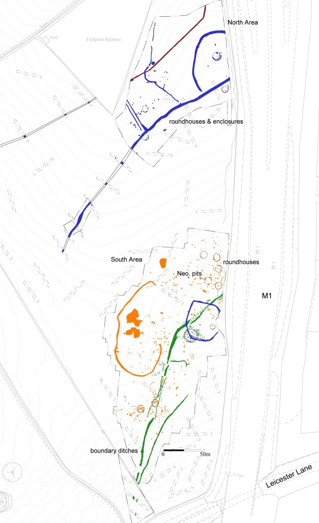
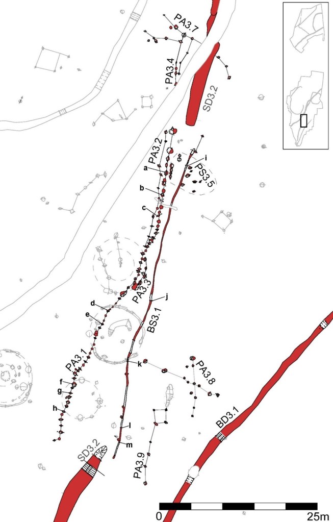
A substantial later Prehistoric site was also exposed, indicating settlement through the majority of the first millennium BC, i.e. the Late Bronze Age and Iron Age periods. Both Middle and Late Bronze Age pottery was found on the site, but came from later features so the nature of Bronze Age activity is still unclear. Into the Iron Age, the site was first crossed by a unique boundary consisting of a pair of ditches. The larger ditch was dug as a series of segments and one of the gaps was, at one point, almost closed off by a line of timber posts and a near-parallel beam slot, both measuring over 50m long. These structures may have been a territorial boundary of Early Iron Age date (750-450 BC), and a border that was respected over a long period. Early Iron Age pottery was found both from, and in the vicinity of, these features.

Several large ditched enclosures and boundaries were later dug, probably in the Middle Iron Age period (450-100 BC). One of these was a D-shaped enclosure on the site plateau, and a further large C-shaped example was constructed to the west, which had a very wide east-facing entrance. These may have been ‘corrals’ for managing livestock, as little occupation material was found within them and they bear little relationship to nearby domestic activity. Across the site, finds of animal bone show that cattle were the main livestock although sheep and pigs were also kept. Grain was being milled on site, with 30 millstones or ‘querns’ being found, but the indications are that the grain was produced elsewhere and traded in, perhaps in exchange for the pastoral products – beef, mutton, milk etc.
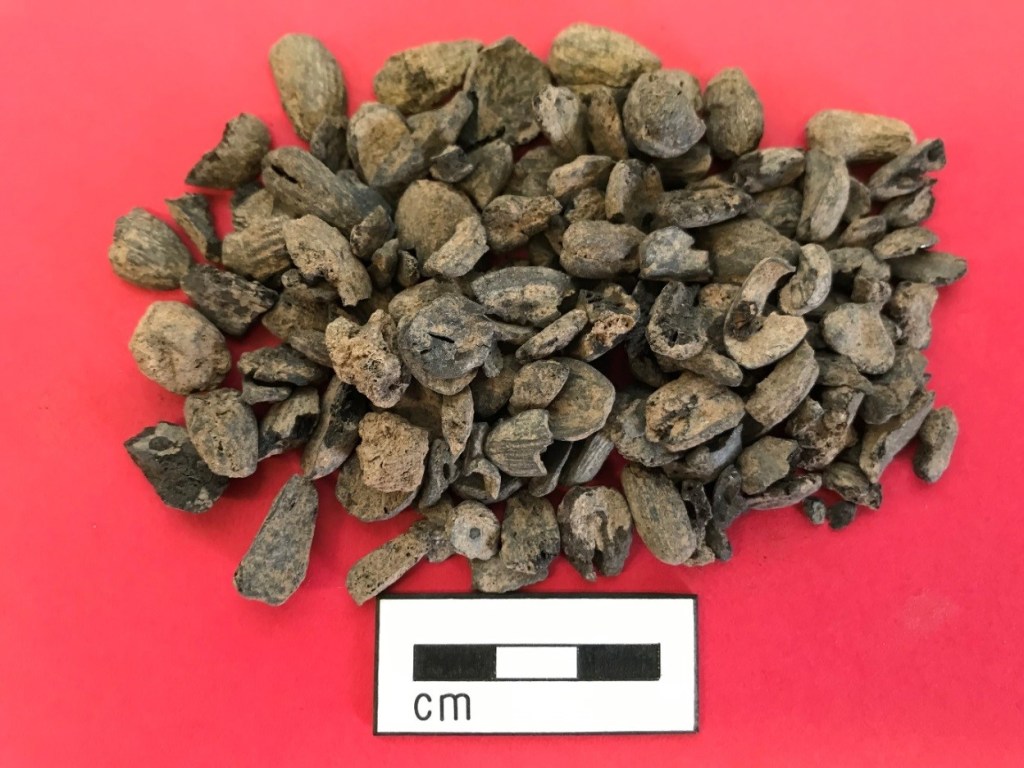
There were finds showing that textiles were made on site, including spinning and weaving artefacts, so textiles may have also been traded. Only a few of the querns were from stone, which was not locally available, and generally the finds from the site suggest that the people living here were largely self-sufficient, with few examples of exotic traded goods. As well as the farmed products the results showed that wild plants and animals were also exploited, including one rare example of a store of acorns, perhaps a specialist food or used in a time of need.
Other enclosures formed boundaries for occupation areas. Across the site, were at least ten roundhouse-type circular structures. One was unusual, being larger, and of multiple concentric structural ring grooves, and may be Early rather than Middle Iron Age in date and broadly contemporary with the large territorial boundaries already identified. This roundhouse was in a special place, on the edge of the plateau with a wide vista to the south and west.

In the southern area roundhouses were uncovered which produced evidence that they dated to the Middle Iron Age. Many associated features were identified, indicating a substantial occupation site. Pottery was probably made on site, and a group of small pits reused many times may have been to extract a good quality local clay. Scored ware pottery indicating a Mid-Late Iron Age date for activity was more common on the plateau near to the D-shaped enclosure, and additionally in the north area where more roundhouses, enclosures and boundary ditches were excavated.


A good group of radiocarbon results was produced indicating a long-lived site. Tying these in with changes in pottery types, an increase in refuse, and the form of structures shows changes taking place through the first millennium BC. Occupation was of a slightly later date towards the north than the majority of the activity on site, and there was also a gradual move towards enclosed settlement. The indication is that rather than the site being one large and contemporary settlement, there was shifting settlement over time, with a move northward. Towards the end of activity, from features on the plateau some Late Iron Age or transitional material was also found, but from the Roman period onward the site had no evidence for settlement and probably returned to use as agricultural land. The land remained as farmland through the medieval period, eventually becoming part of the outlying land for The Park, the grounds reaching out from Enderby Hall.
The site was excavated on behalf of Mather Jamie prior to the development of a Strategic Employment Site.
