In 2018, University of Leicester archaeologists carried out excavations at the former Park Hill Golf Club in Seagrave, near Loughborough, in advance of Leicester City’s redevelopment of the site as a new football training ground. Site director Leon Hunt reports:
Little was known about the archaeology of the area prior to this work. The Historic Environment Record for Leicestershire and Rutland identified that human activity dated back to the Mesolithic (10 000 BC – 4000 BC) and Neolithic/Early Bronze Age periods (4000 BC – 1500 BC) and included a Mesolithic pebble hammer as well as Early Bronze Age flint tools, including an arrowhead. Iron Age (800 BC – AD 43) and Roman (AD 43 – AD 409) pottery and quern stones had also been found nearby and suggested settlement in the area.
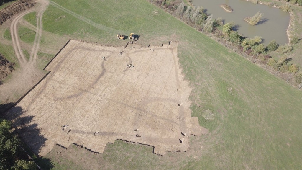
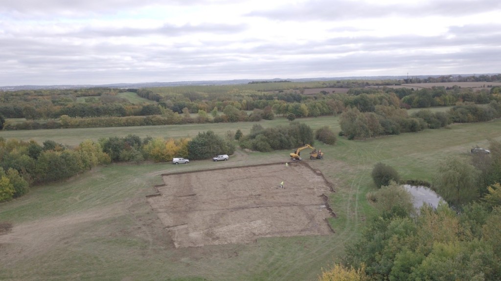
Archaeological work in connection with the new training ground was ongoing throughout 2018. A geophysical survey by WYAS Archaeological Services of the former golf course revealed a large rectangular enclosure within the driving range on the higher ground, with internal enclosures and other ditch features. On the lower ground, in the main fairway, were other smaller distinct rectangular enclosures. These were evaluated by Museum of London Archaeology (MOLA) and were dated to the late Iron Age. Considering the results of the initial evaluation, two areas were subsequently chosen for further mitigation work and an excavation was carried out by University of Leicester Archaeological Services (ULAS).

The earliest features were two pit alignments (Phase 1) – a single alignment in the northern excavation area and a double alignment in the southern area. The pits were typically 2m in diameter and spaced 1.5m apart. Pit alignments generally date from the Late Bronze Age into the Iron Age and appear to be an early form of land division within these periods. They are found mainly in the central and eastern parts of England, although they have been known to appear in parts of Yorkshire and even Wales and Scotland. Once a relatively rare form of archaeological feature, their discovery is becoming increasingly common. They are often situated away from the focus of settlement and because of this are often low in artefactual evidence, although increasingly they are found being re-excavated into linear features or associated with later features tacked onto them, such as enclosures as was found in the northern excavation.
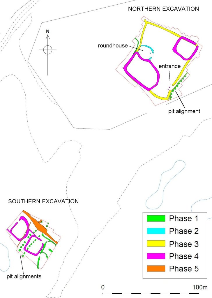
The earliest settlement of the area was a roundhouse (Phase 2) in the northern excavation. This appeared to predate the enclosures and may have originally been part of an unenclosed settlement. Little of the structural remains for the roundhouse survived, with only the deeper outer ‘eaves-drip’ gullies remaining. The roundhouse entrance faced east, a typical orientation for a domestic Iron Age dwelling, either to catch the sun in the morning and to face away from the prevailing westerly wind, or because it was simply the ‘right’ way to situate the entrance.
The roundhouse was later incorporated in a large rectangular enclosure (Phase 3) which formed the dominant and largest enclosure of the settlement, measuring 67m x 61m. It reused the roundhouse gully on its western side placing the roundhouse at the back of the enclosure opposite the entrance. Many later Iron Age settlements throughout the region, and throughout southern Britain as a whole, began as unenclosed settlement to be enclosed later. There was no evidence of other structures, or rubbish pits within the enclosure, save for two possible post-holes close to the entrance, which may have been for some kind of gate structure.
Later, the main rectangular enclosure was replaced by two smaller enclosures (Phase 4) over its north-east and south-west corners. This sub-division of enclosed space within the settlement is common on many excavated Iron Age sites and given that there was no evidence of industrial activity it is assumed that the sub-enclosures represent stock pens, with the smaller northern enclosure perhaps being used for a different range of stock to the larger southern enclosure (sheep/goats as opposed to cattle or horse). These are broadly similar in form and date to two small enclosures in the southern excavation, 200m to the south, and represent a reorganisation of space in this area, perhaps with new occupation areas located outside the foci of the excavation.
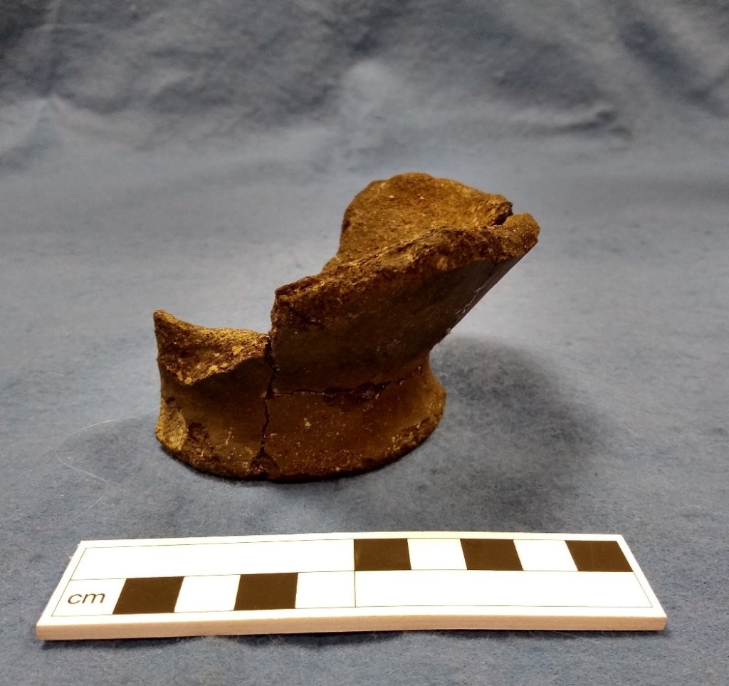
The ditch of the northernmost small enclosure contained the dumped, fragmentary remains of a perforated oven plate made of clay. It is relatively rare to see survival of such oven plates as they were set into the floors of roundhouses, and truncation by later ploughing usually destroys them. The function of the plate was to provide a flat surface for cooking and presumably a cooking pot could have been placed over the large central perforation. Its presence in the ditch may be the result of deliberate dumping of artefacts and material after the settlement was abandoned.

There was a slight difference in the number and type of animal bones retrieved from the different areas with cattle more numerous than other animal remains in the northern excavation. In the southern excavation cattle and sheep/goat were equally represented. Smaller quantities of pig, horse and dog were also identified. The animal remains represent general domestic refuse and many of the bones showed signs of gnawing from dogs. Burnt plant remains were poorly preserved in the ditch fills and likely represent residual scatter from food waste spillage which had become burnt on a hearth. Barley and glume wheat were both present and together, the faunal and floral assemblages suggest a mixed farming economy.
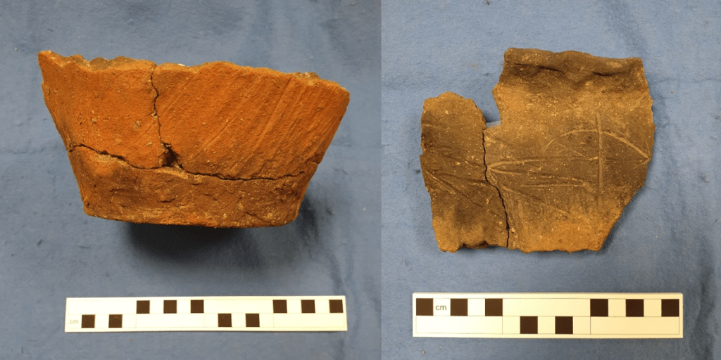
Pottery from the site was mostly East Midlands scored ware. Vessels included jars and bowls ranging in diameter from 150-300mm, with the larger jars being the more common form. ‘Scoring’ was a deliberate style of decoration that varied from light twig brushing, single finely scratched grooves to deeper and wider lines, used both alone and in combination. As a technique, scoring was most common in the 2nd and 1st centuries BC. Most of the pottery was recovered from ditch fills in the northern excavation.
In the southern excavation, north of the Iron Age activity several ditches, furrows and field drains forming a large linear feature of probable medieval date (Phase 5) as it was on the same alignment as the ridge and furrow earthworks in the area. Both areas were also crossed by post-medieval ditches. These were former field boundaries which were shown on early OS maps of the area but were removed during the construction of the golf course.
The site of Leicester City’s new training ground has elements which are common in the archaeological record for the later Iron Age. The archaeology is similar to recently excavated sites in Leicestershire, particularly at Birstall, Enderby and Humberstone. Not only does it have comparable archaeological features but the pottery assemblages, with the relatively high proportion of scored vessels, is the same, giving activity on the site a Late Iron Age date with no evidence that activity continued into the Roman period.
The archaeological work at Seagrave, although small in scope has still added new information to the study of the later Iron Age in the East Midlands. Read the full excavation report on the Archaeological Data Service at https://doi.org/10.5284/1076559
